Gis Viewer
Advertisement

Thuban for Linux v.1.2.2
Thuban is an interactive geographic data viewer (GIS viewer) which features methods to visualize, explore, and analyze geographic information.
Advertisement
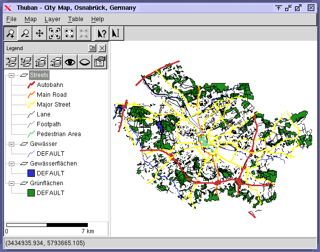
Thuban for Mac OS X 1.0.1-3 v.3
Thuban is an interactive geographic data viewer (GIS viewer) which features methods to visualize, explore, and analyze geographic information.
Thuban for Windows v.1.2.2
Thuban is an interactive geographic data viewer (GIS viewer) which features methods to visualize, explore, and analyze geographic information.
Gismaps Viewer v.1. 3. 3524
Gismaps Viewer is a GIS viewer that can be used for geospatial analysis and map production.
ArcGIS Explorer Desktop Current User v.10.0
ArcGIS Explorer is a free, downloadable GIS viewer that gives you an easy way to explore, visualize and share GIS information. ArcGIS Explorer adds value to any GIS because it helps you deliver your authoritative data to a broad audience.
Free Shapefile Viewer v.5.3.1
The free AvisMap Viewer opens most GIS/CAD and raster image file types and most ArcView, ArcExplorer, and MapInfo projects.
TatukGIS Viewer v.2.9.0.5307
TatukGIS Viewer opens most GIS/CAD vector, raster image, and grid file types, including the aerial imagery and vector street map data provided by the leading vendors, most ArcView, ArcExplorer, and MapInfo projects,
PlanetGIS Explorer v.3.0.8.5190
PlanetGIS Explorer is a free viewer for PlanetGIS maps and GIS exchange files. PlanetGIS Explorer allows you to navigate through maps, query map elements and view attribute information from linked database tables.
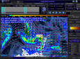
ATMOGRAPH ModelVis v.1.1
ATMOGRAPH is advanced weather model data visualization and analysis software for meteorologists, storm chasers, aviators, forecasters, and enthusiasts alike, combining free data sources from NCEP and NOAA to deliver THOUSANDS of data options.
Eye4Software GPS Mapping Studio v.4.1
GPS Mapping Software for Windows, Loading topographic maps, Realtime navigation, GPS position tracking, Map import and export, Coordinate conversion and more
CartoMAP Viewer v.2.0
CartoMAP Viewer can help you to view GIS files.CartoMAP Viewer Features: 1. Use with any database 2. Supports for ArcView shape and MapInfo files 3. Import DXF Entities 4. Various spatial analysis functions 5. Various thematic routines 6. Automatic